PRODUCT INTRODUCTION

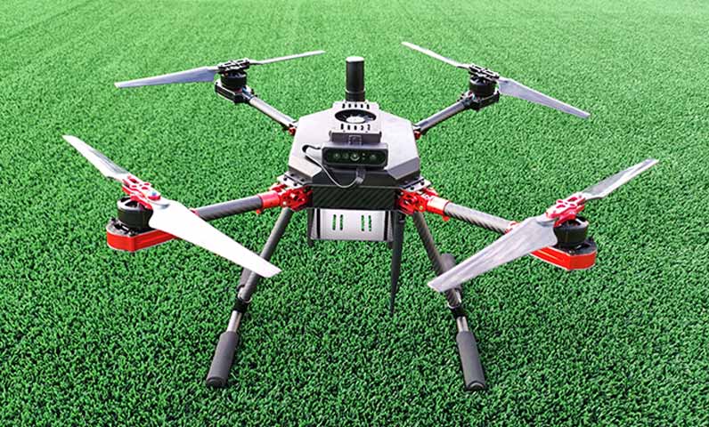
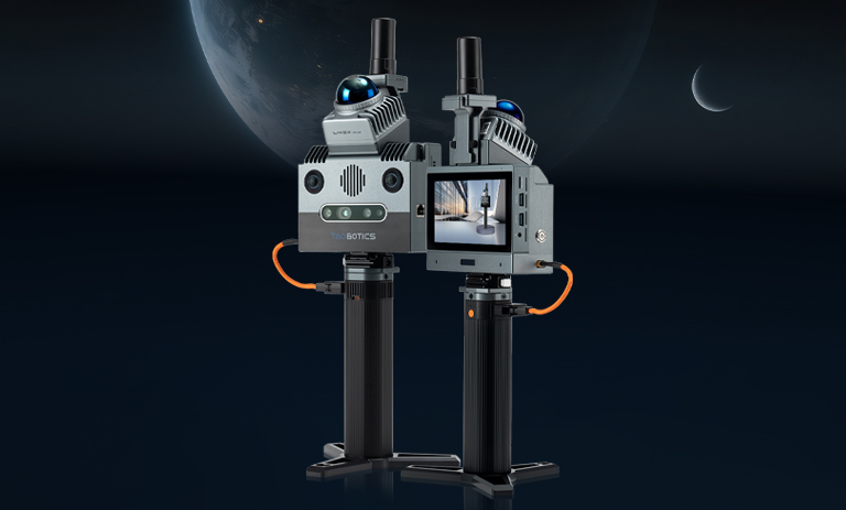
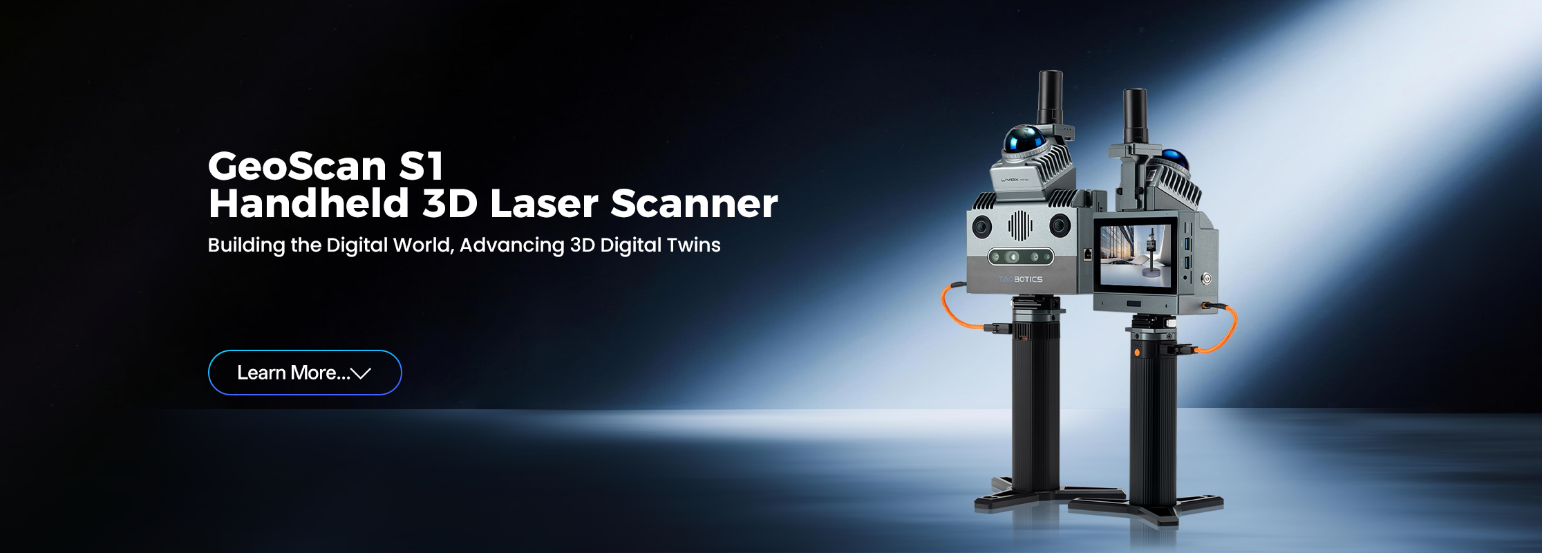
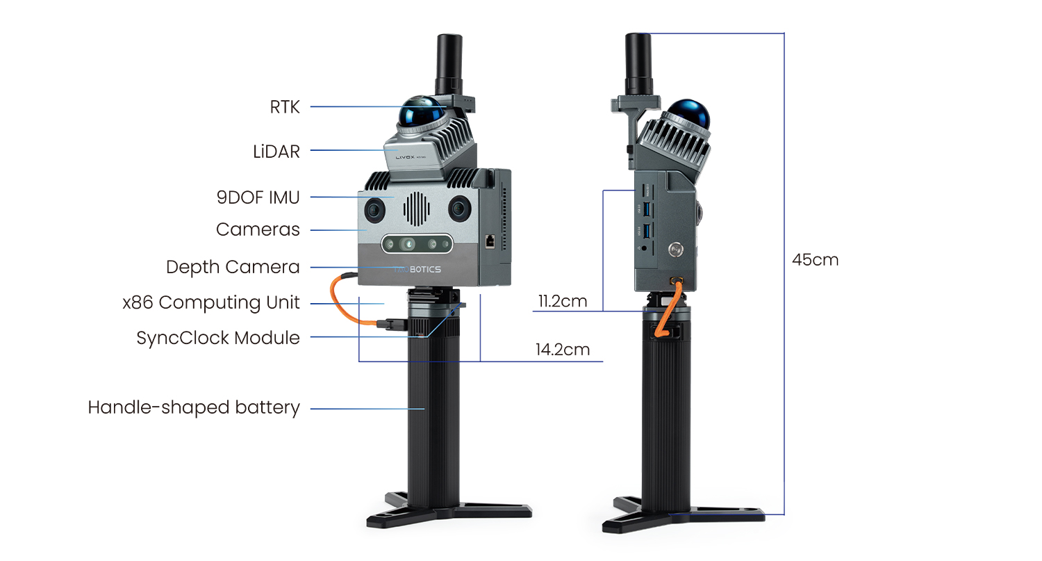
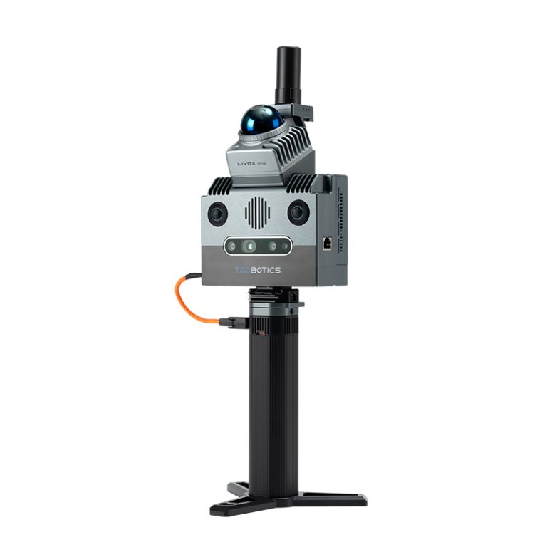
GeoScan S1: The Ultimate Cost-Effective Handheld 3D Laser Scanner is Now Available!

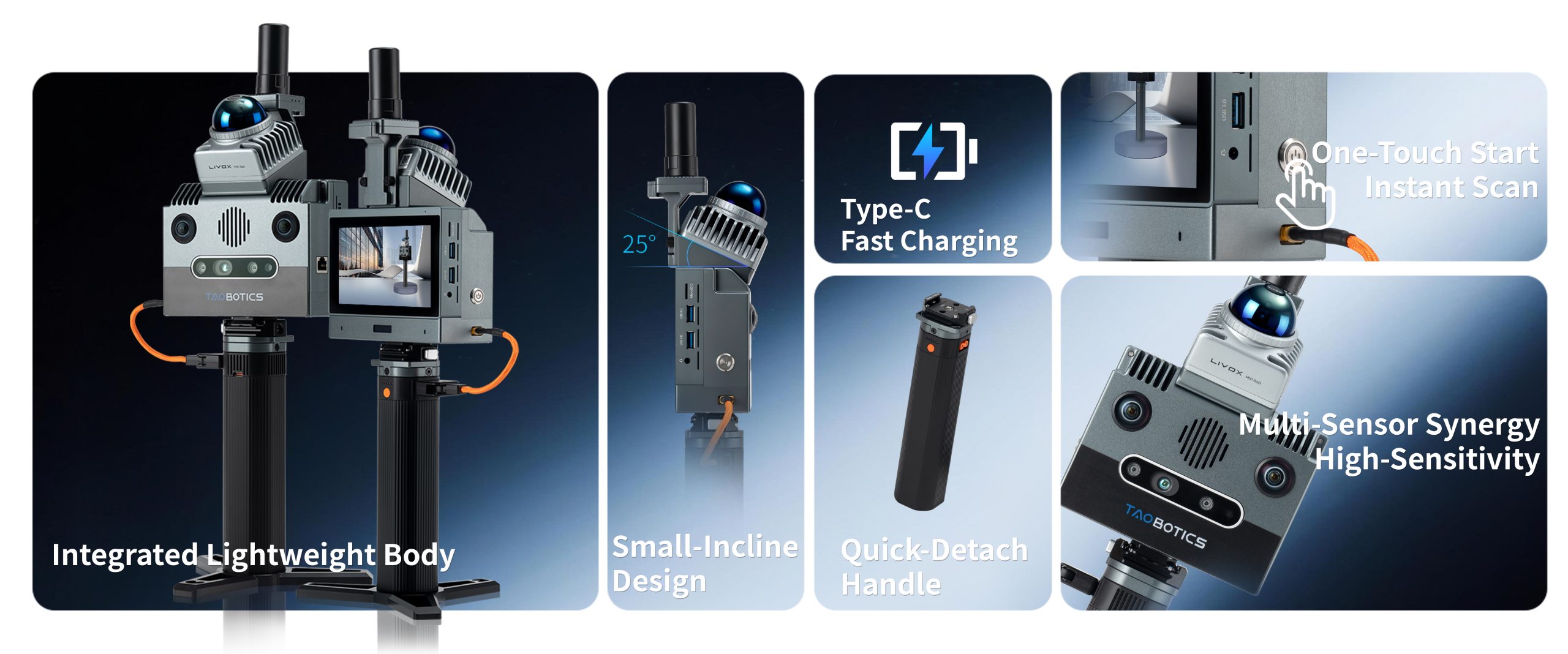
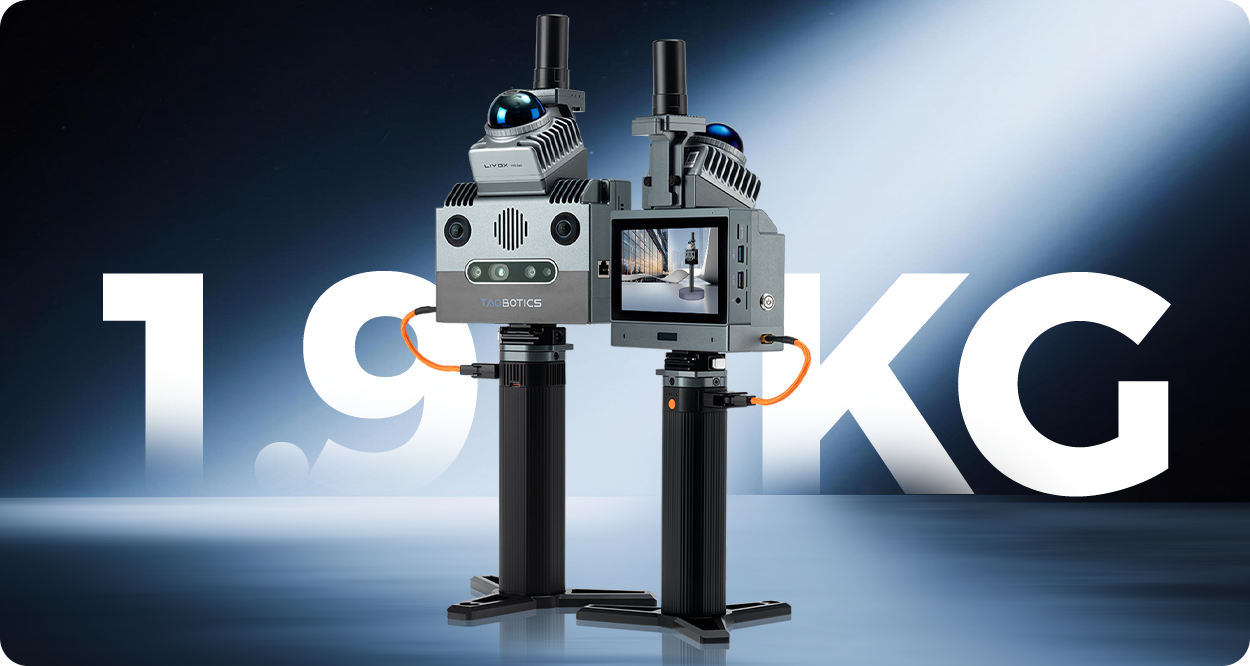
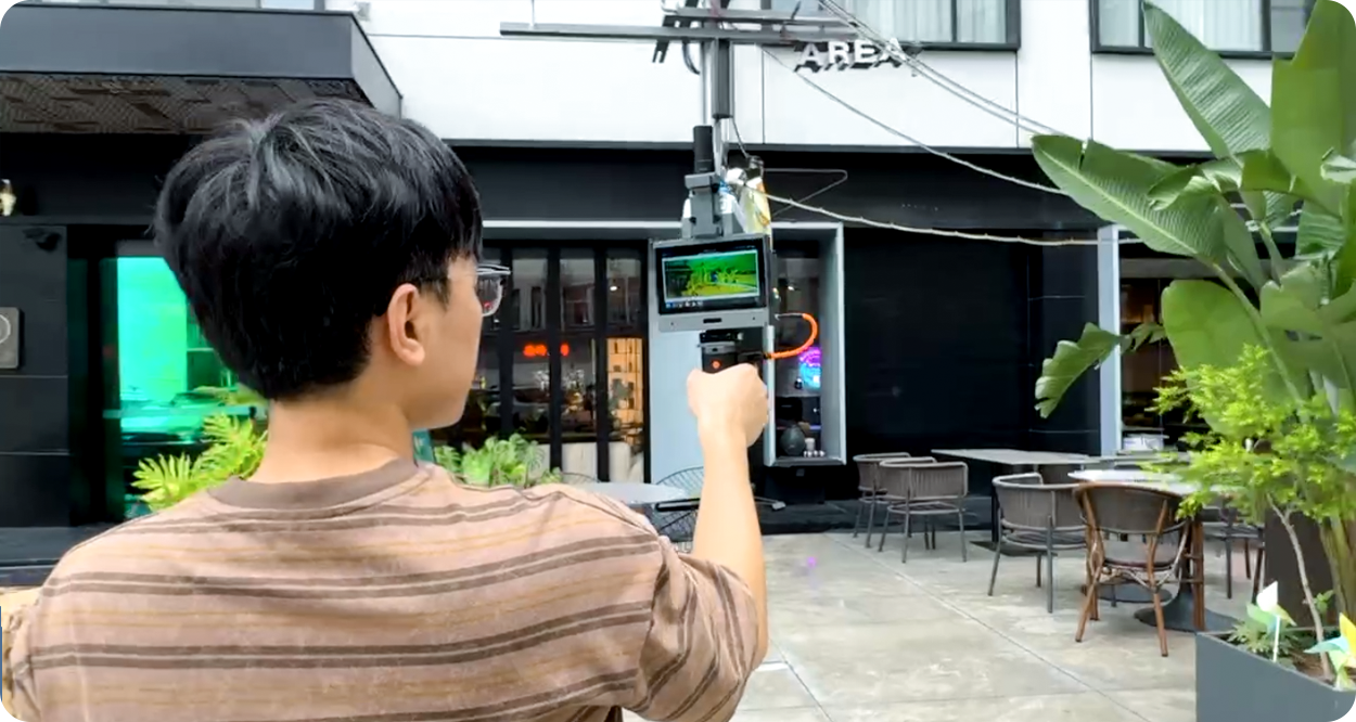
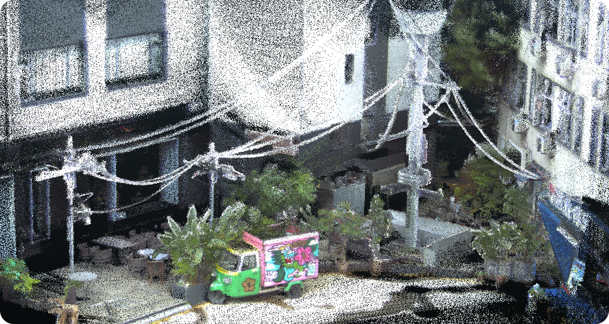
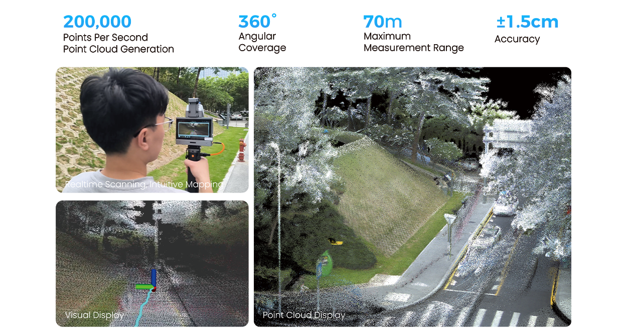
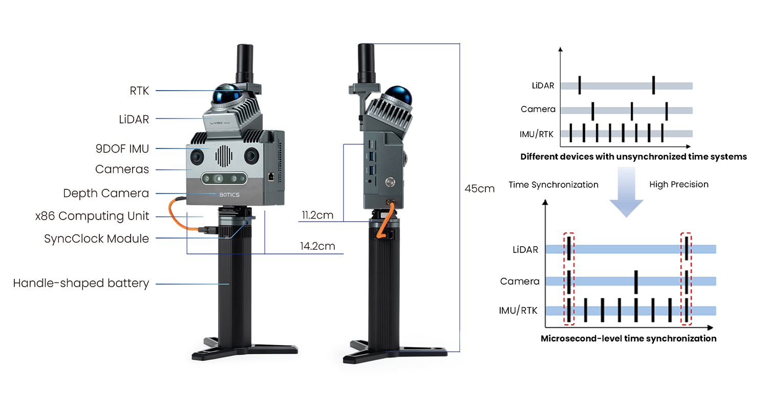
Featuring a lightweight design and one-touch operation, this device provides an efficient and practical 3D solution. Driven by multi-modal sensor fusion algorithms, it enables real-time reconstruction of 3D scenes with centimeter-level accuracy, adaptable to a wide range of industrial and environmental applications.

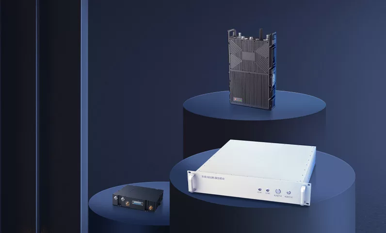
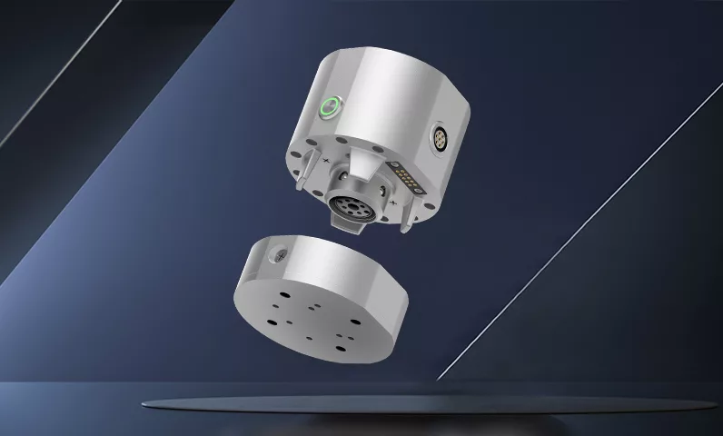
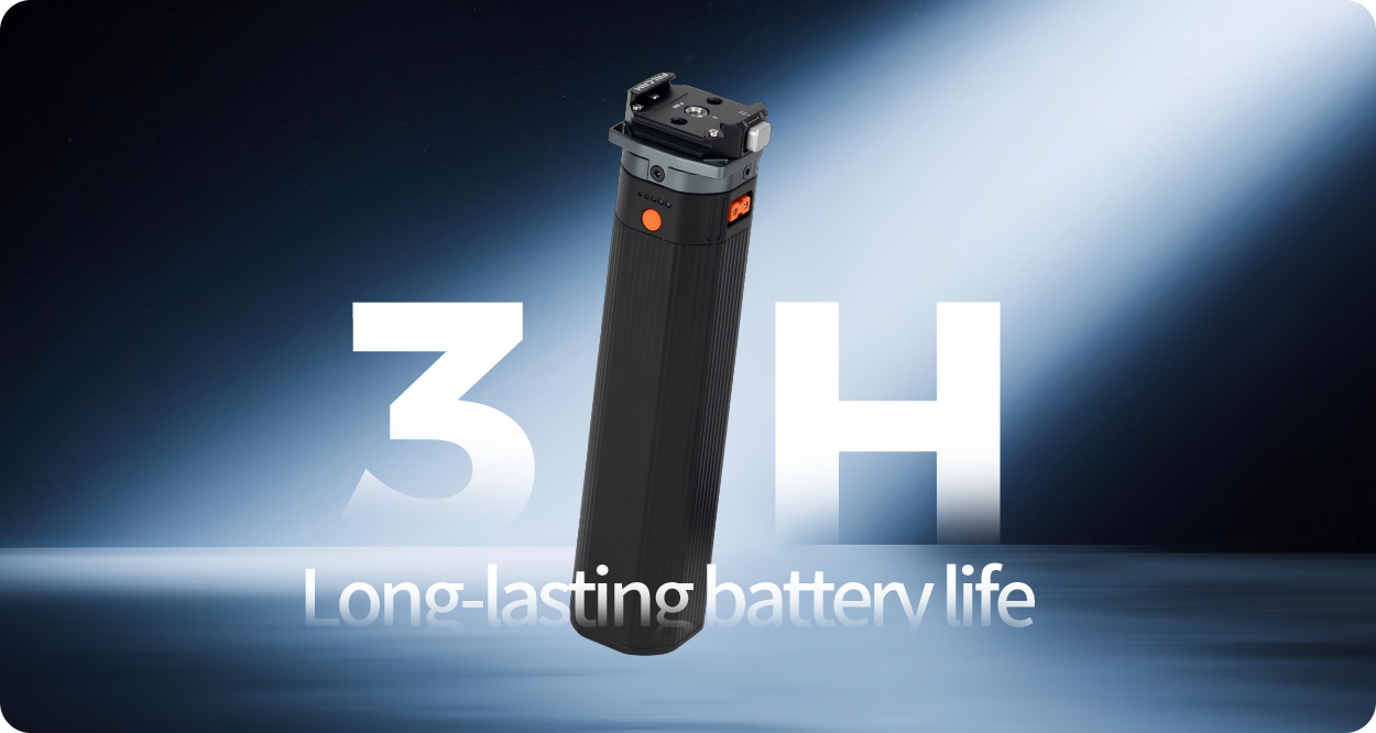
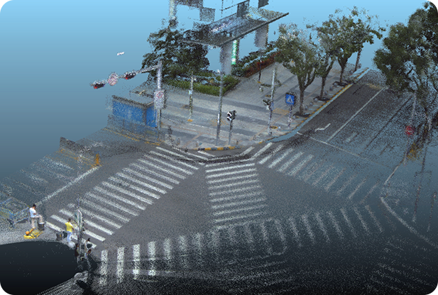
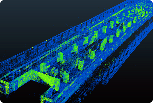
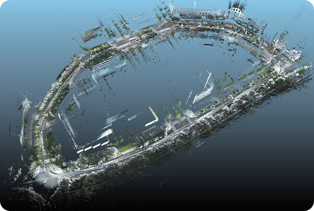
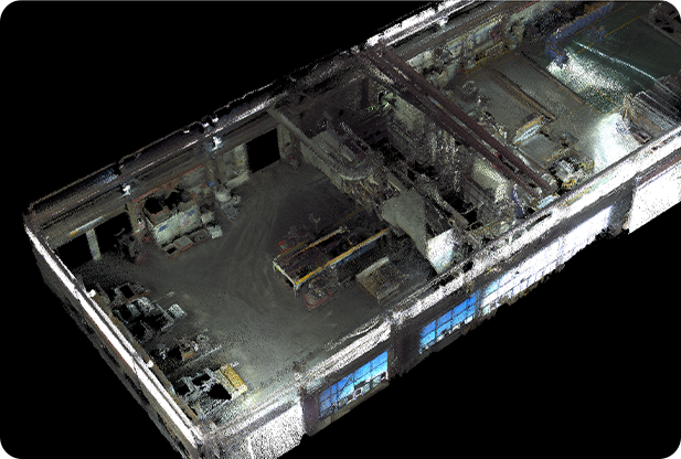
With 200,000 points per second mapping capability, a 70-meter measurement range, and 360° full coverage, it effortlessly handles large-scale scenes exceeding 200,000㎡. The optional 3D Gaussian data capture module ensures high-fidelity real-world replication, while cross-platform integration—supported by a high-bandwidth Ethernet port and dual USB 3.0 interfaces—offers flexible expansion for research and experimentation.

Designed to lower development barriers, it empowers developers to rapidly acquire R&D capabilities and unlock limitless innovation possibilities!

PRODUCT FEATURES

​​Multi-Sensor Fusion​​

Microsecond Synchronization​​

High-Precision Scanning​​

Large-Scene Coverage

Multi-Scenario Adaptability​​

Lightweight & Portable

Real-Time Mapping Preview​​

Multi-Format Export​​

Support unmanned platforms

SDK Support​​

ROS Support​​

Use Tutorial

Lightweight & Integrated, Ready for Immediate Use​

Lightweight design with highly integrated sensors; one-touch start for instant handheld operation.

HD Full-Color Display with Real-Time Preview​

High-definition touchscreen enables real-time tracking of scanning effects.

​​True-Color Mapping for Realistic Rendering​

Supports colorized 3D modeling, capturing true lighting and textures instantly.

Quick-Detach Handle & Extended Battery Life​

3-4 hours long-lasting operation; handle supports tool-free removal.

Designer and manufacturer of mobile robots, shipped to over 50 countries worldwide

Real-time Modeling with High-fidelity Reconstruction

Multi-sensor fusion, microsecond-level data synchronization, and real-time online mapping. Equipped with high-precision multi-sensor SLAM mapping algorithms, the system outputs high-accuracy point cloud data in real time. Integrated with a high-definition color camera, it generates richly colored point cloud data.

Multi-sensor Fusion Technology

Equipped with years of in-house developed multi-sensor fused SLAM algorithms and ultra-high precision IMU modules, it leverages advanced calibration technologies and microsecond-level data synchronization to effortlessly handle complex indoor/outdoor environments, comprehensively meeting surveying and mapping demands.

Efficient Mapping, 200,000 sqm Real-Scene Reconstruction​​

Lightweight & Handheld, Boundless Coverage!​​ Maximum scanning area exceeds 200,000 square meters, efficiently capturing buildings, equipment, and complex terrain. Precisely constructs digital models, enhancing time efficiency in survey management.

Cross-platform Integration for Unmanned Operations

Supports cross-platform integration and compatibility with diverse payload platforms (e.g., UAVs, UGVs, robotic dogs, humanoid robots), enabling seamless unmanned workflows.

Multi-sensor System for Complex Scenario Capability

Integrates multiple sensors to excel in diverse indoor/outdoor environments, including office buildings, parking lots, industrial parks, tunnels, forests, and mines, accurately constructing 3D scene maps across all working conditions.

3D Gaussian Real-World Reconstruction

Equipped with an optional 3D Gaussian module, it achieves high-fidelity real-world reconstruction, digitally replicating physical environments with precision

Supports secondary development

APPLICATION CASE

TECHNICAL PARAMETER

System Parameters

Measurement Mode

3D point cloud map dynamic construction, color fusion, real-time preview

Multi-sensor Fusion

Fusion of camera, LiDAR, IMU, GPS

Scanning Area

Up to 200,000 square meters 

Mapping Real-time

Supports real-time computation

Point Cloud Rate

200,000 points/second

Colored Point Cloud

Supported

Export Formats

PCD, LAS, PLY, and other common formats

System Environment

Ubuntu 20.04, ROS-compatible

Relative Accuracy

Better than 3 cm

Absolute Accuracy

Better than 5 cm

General Parameters

Dimensions (LWH)

14.2cm * 9.5cm * 45cm

Power Input

13.8V – 24V

Power Consumption

25W

Battery Capacity

88.8Wh

Weight

1.2 kg (excluding battery), 1.9 kg (including battery)

Operating Time

Approx. 3h ~ 4h

Storage Capacity

256G

Housing Material

Aviation-grade aluminum

Power Supply Method

Magazine battery

Touchscreen

5.5-inch @1280×720

Computing Unit

Model

Intel N5095

CPU Specifications

4-core 2.0GHz (Turbo 2.9GHz), 4MB cache

Memory/Storage

16GB/256GB (expandable via TF card)

Wireless Connectivity

Wi-Fi/Bluetooth, 2.4G/5G

External Interfaces

Gigabit Ethernet, USB3.0*2, Micro SD, 3.5mm audio port

Microsecond Sync Module

Sync Mode

Hardware IO trigger synchronization

Sync Precision

Microsecond-level

High-precision IMU

Frequency

Up to 800 Hz

Data Package

Acceleration, angular velocity, magnetometer, attitude angle (quaternion)

Factory Calibration

Static, dynamic, temperature zone, nonlinear calibration, axis alignment

RTK

Model

T-RTK UM982 Mobile

Antenna

Full-frequency quadrifilar helix antenna

LiDAR

Model

Livox Mid-360

Depth Camera

Model

Intel D435i

Industrial Camera

Quantity

2

Exposure Method

Global shutter

Resolution & Frame Rate

Color image, up to 1280×1024 @201fps

Field of View

180°fisheye

GeoScan S1

3D Real Scene Laser Scanner

$3980 only

The price is for reference only, and the actual price is subject to settlement.