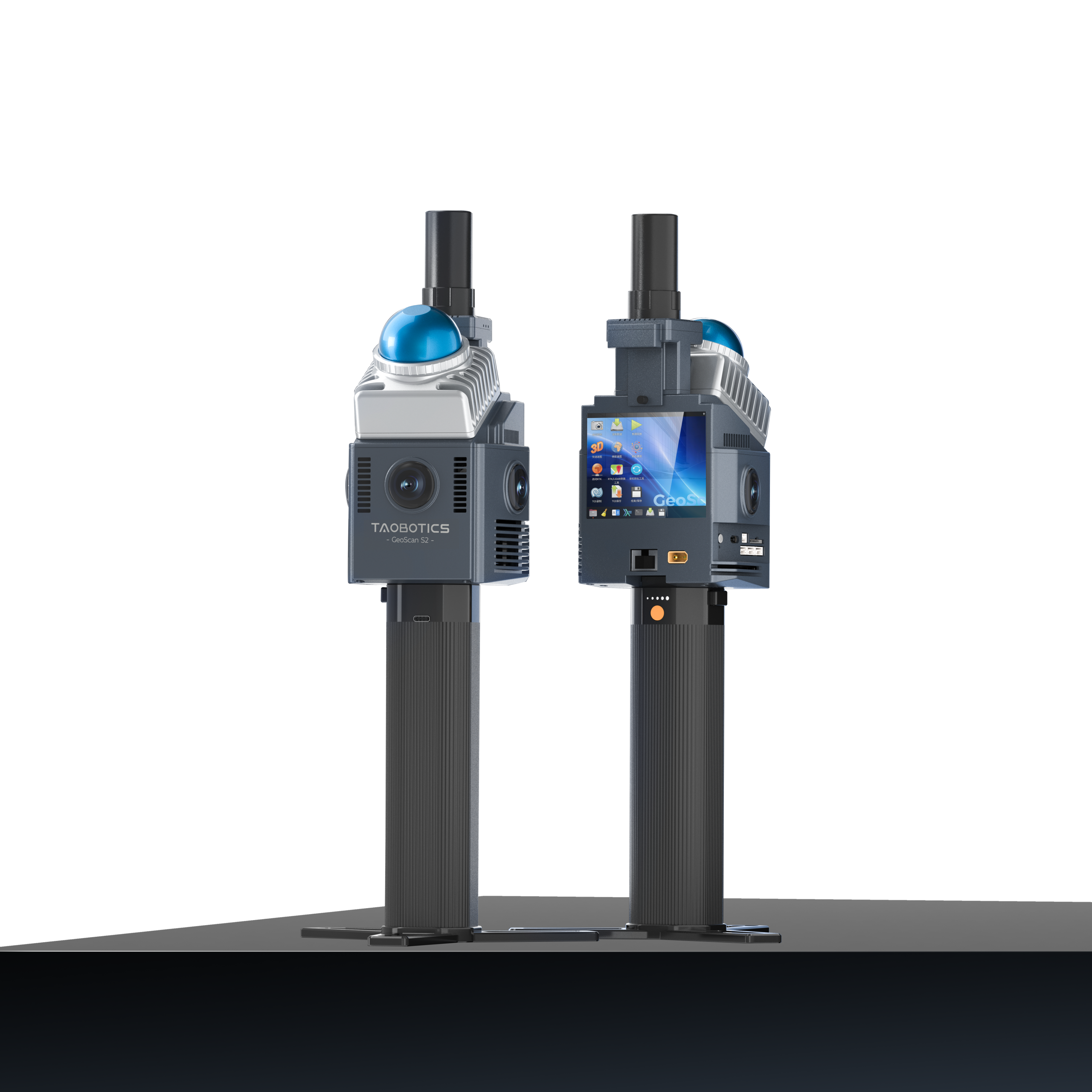
Product Introduction
The GeoScan 3D laser scanners is developed by Taobotics. The GeoScan supports real-time generation of centimeter-level colored 3D maps. Equipped with powerful onboard computing and versatile interfaces, it can integrate with drones and robots while supporting remote control and beyond-line-of-sight data monitoring. It enables single-session mapping over 120 minutes and covers a modeling area exceeding one million square meters. Even under harsh conditions—such as vehicle speeds of 40 km/h or severe vibrations on unpaved roads—GeoScan maintains stable operation. Having undergone rigorous testing in over a hundred real-world applications, GeoScan delivers precision for surveying, construction, forestry asset management, gaming archaeology, urban digitization, and more.
Equipped with abundant interfaces for secondary robot development.

Multi-sensor Fusion

Teleoperation

Secondary Development

Multi-platform Real-time Preview

3D Reconstruction

Microsecond-level Synchronization

Multiple Scenarios Application

Ready to Use Upon Export

Global Autonomous Navigation

High-speed In-vehicle Modeling
Precision Integration Lightweight Powerful
Powerful Computing
Eliminates dependence on external devices to ensure secure data acquisition
Real-Time Imaging
The entire process of real-time acquisition, modeling, preview, and export is completed internally
Column Projection
Circular Garden
Colorful Vegetation
Road Details
1.43Kg Ultra-Light weight
Say goodbye to heavy workloads Achieves the perfect balance between efficiency and comfort
120Min Single Operation
One-time data acquisition for large scenes Reduces stitching workload
Open Ecosystem
Support for ROS, Pixhawk, etc.Open Ecosystem
Secondary Development
Reserved robot secondary development interfaces such as Ethernet, USB, Serial, CAN, etc.
Smart sensing across various scenarios
Large Scene
Single-operation area exceeding 1 million m² ,One-click generation of real-world true-color point clouds
Multi-mode
It has built-in multiple surveying modes to adapt to various task requirements
All Environment
Unrestricted by network, GNSS, or lighting limitations; precise even in complex environments
High Efficiency
Empowering various fields such as surveying, forestry, engineering, and smart cities
Remote Intelligent Control Real-Time Detection
30KM Remote Control
Achieves remote control by pairing with a 3-30 km teleoperation module
BVLOS Data Monitoring
Multi-modal data provides decision-making support for scenarios such as emergency response and inspection
Real-time Synchronization
Remote Control
Scanned data and mission commands can be synchronized and interacted with at any time,ensuring seamless connection between on-site surveys and remote command
Data-driven
Seamless Empowerment
Real-time visualization of multi-modal data such as images, maps, and trajectories enables remote execution of data collection tasks
3D Perception
Reliable Decision-Making
Provides a data foundation and decision-making basis for usage scenarios,Such as 3D situational awareness at emergency sites and robot inspections
Unshakable Precision
40KM/h
Supports bicycle and vehicle-based high-speed data collection
High Stability
Stability Sustainable and stable mapping in high-speed environments
Stable mapping even under harsh conditions such as vehicle travel at 40 km/h
and severe vibrations on unpaved roads
S2 performs data collection at 40 km/h
10-minute on-board street point cloud collection
Custom Development
We provide customized development for specific
customer use scenarios,
such as fire emergency response, smart mining,
and digital twins
Proven & Trusted
Proven across hundreds of real-world projects, GeoScan S2
delivers consistent performance for industrial, governmental,
and scientific applications
Smart Transformation! GeoScan + Robot Reshaping Engineering Acceptance
GeoScan makes a spectacular debut equipped with intelligent acceptance robots, driving the intelligent transformation of the engineering supervision industry through innovative technology and opening a new chapter for efficient industry transformation.
Featured on CCTV! GeoScan Becomes a Benchmark Case for "Excellent Engineer" Training
GeoScan appeared on CCTV NEWS. In a special report on the cultivation of “Excellent Engineers,” it was featured as advanced teaching and research equipment, representing the innovative achievements of the deep integration of “industry, academia, research, and application.
Efficiency Revolution! GeoScan + Robotic Dog 3D Scanning Solution
GeoScan is mounted on a robotic dog to realize “scan-while-walk” automatic modeling. It completes 10 times the workload of traditional methods in 40 minutes, with centimeter-level accuracy, efficiently empowering grassroots construction scenarios.
Splashed Realit
Integrated with TGS 3D Gaussian Splatting, raw point clouds are transformed into highly realistic 3D scenes.
Park stone monument
Ancient city wall
portrait sculpture
elephant fountain
Industry Applications
High-Precision Spatial Data Acquisition and Modeling
>>Indoor & outdoor building surveying
Rapidly acquire complete 3D data of building interiors and exteriors to generate high-precision drawings, significantly improving surveying efficiency and data accuracy.
>>Digital reconstruction of tunnels and utility galleries
Dynamically collect point clouds in GPS-denied environments for construction quality control as well as deformation and defect detection during the operational phase.
Digital Management of the Full Project Lifecycle
>>Dynamic monitoring of construction progress
Regularly scan to quantify construction deviations, achieving data-driven refined management of progress and
costs.
>>Accurate measurement of material pile volumes
Rapidly acquire 3D surface data of stockpiles to accurately calculate volumes, providing a reliable basis for inventory management and trade settlement.
Intelligent Inspection and Safety Warning for Critical Facilities
>>Indoor & outdoor building surveying
Rapidly acquire complete 3D data of building interiors and exteriors to generate high-precision drawings, significantly improving surveying efficiency and data accuracy.
>>Digital reconstruction of tunnels and utility galleries
Dynamically collect point clouds in GPS-denied environments for construction quality control as well as deformation and defect detection during the operational phase.
Parameters
| Model | Basic Version | Standard Version | Developer Version | |
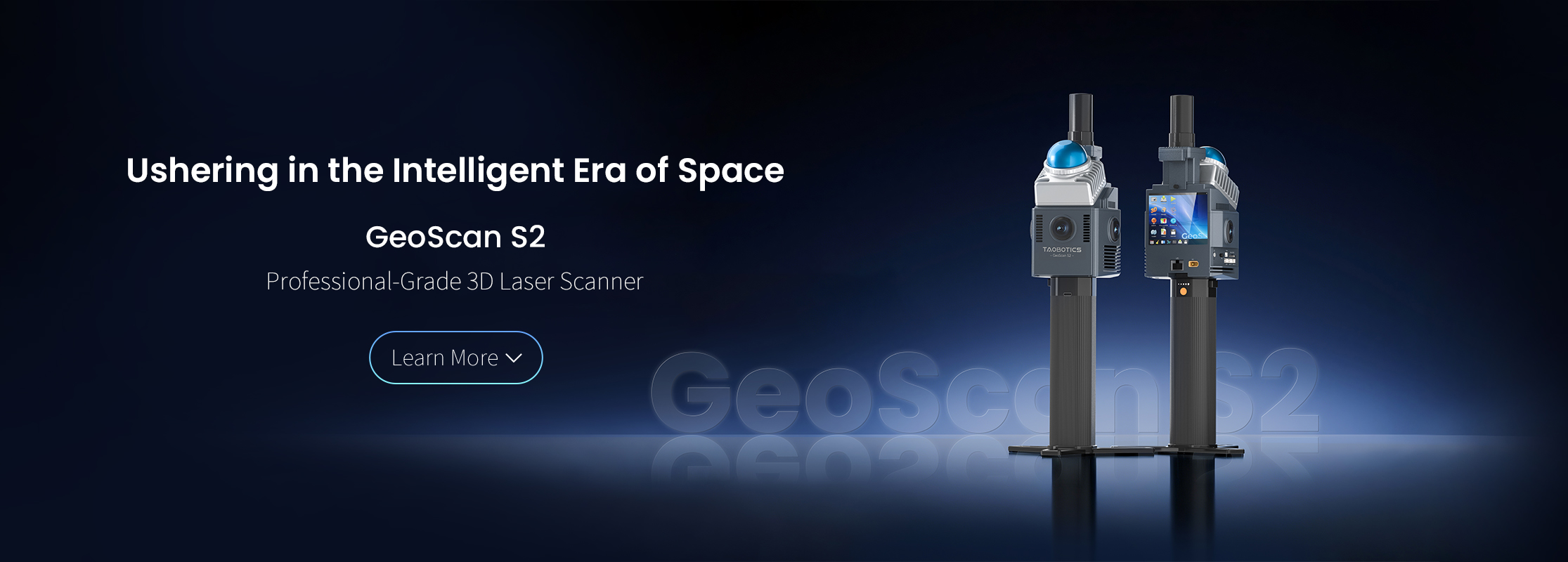
| System Parameters | Measurement Mode | Dynamic construction of 3D point cloud map, color fusion, real-time preview | ||
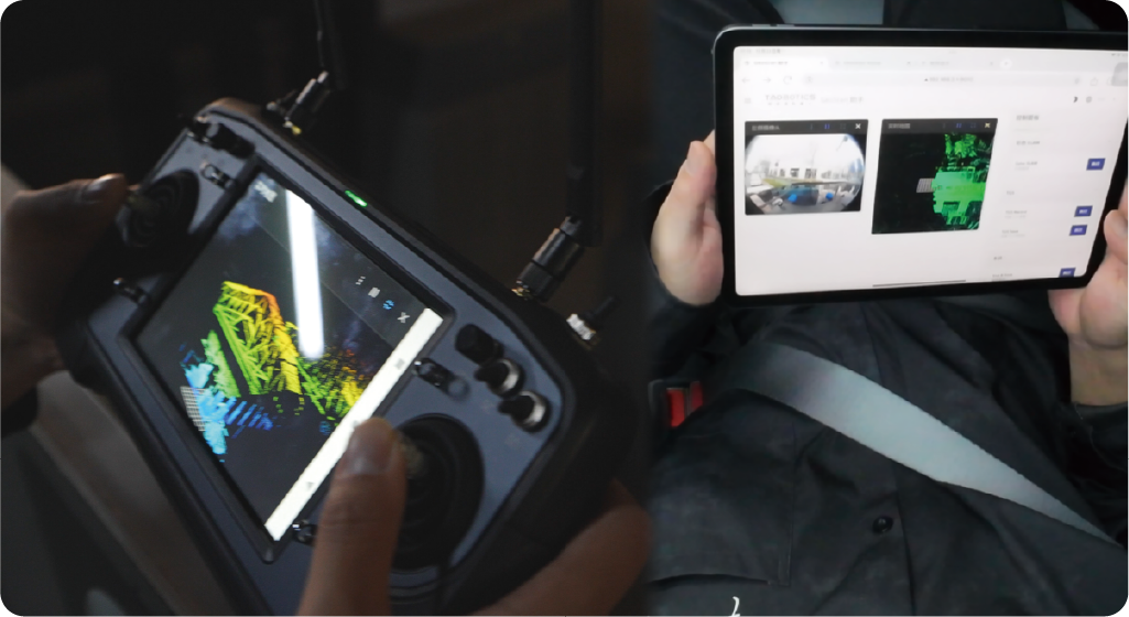
| Remote Control and Monitoring | \ | By ground station or web interface | ||
| Multi-sensor fusion | Fusion camera、Lidar、IMU | Fusion camera、Lidar、IMU、GPS | ||
| Scanning area | More than 1,000,000 ㎡ | |||
| Real-time map construction | Supports Real-Time Solving | |||
| Number of point clouds | 200,000 points/second | |||
| Color point cloud output | Support | |||
| Export data format | pcd, las, ply and other common formats | |||
| System environment | ubuntu 22.04、Support ROS | |||
| Relative accuracy | Better than 1cm | |||
| Absolute accuracy | Better than 5cm | |||
| Start_Camera | Wide-angle camera quick view, exposure parameter adjustment | |||
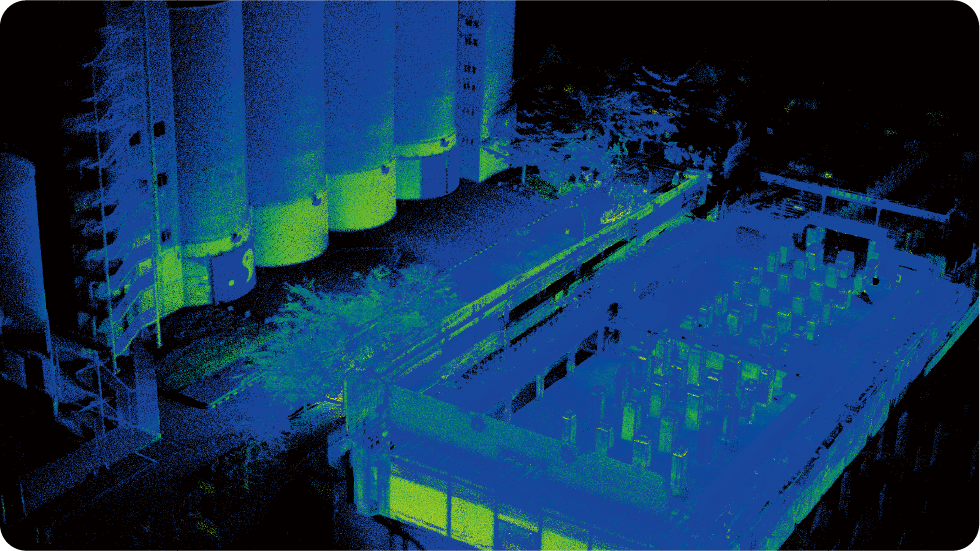
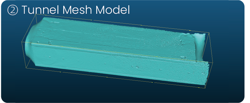
| Quick_SLAM | Fast large scene 3D point cloud map construction | |||
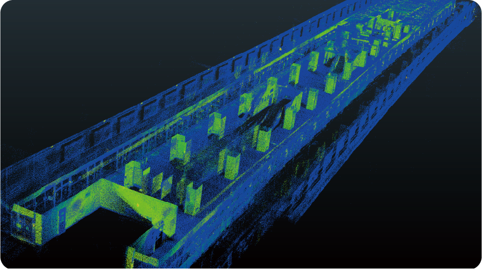
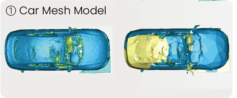
| Geo_SLAM | High-precision intensity information 3D point cloud map construction | |||
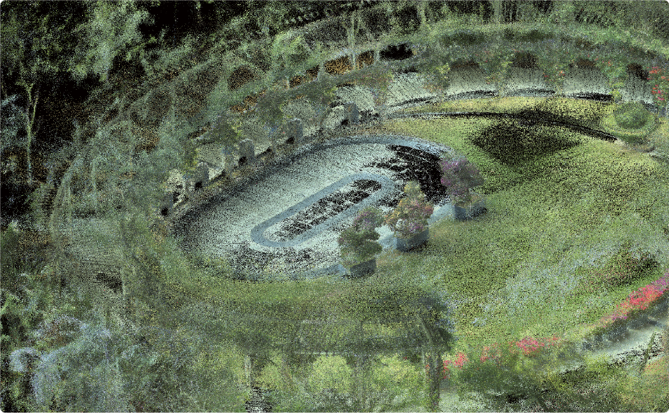
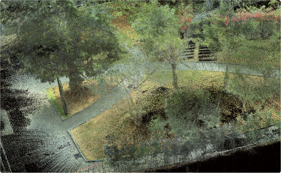
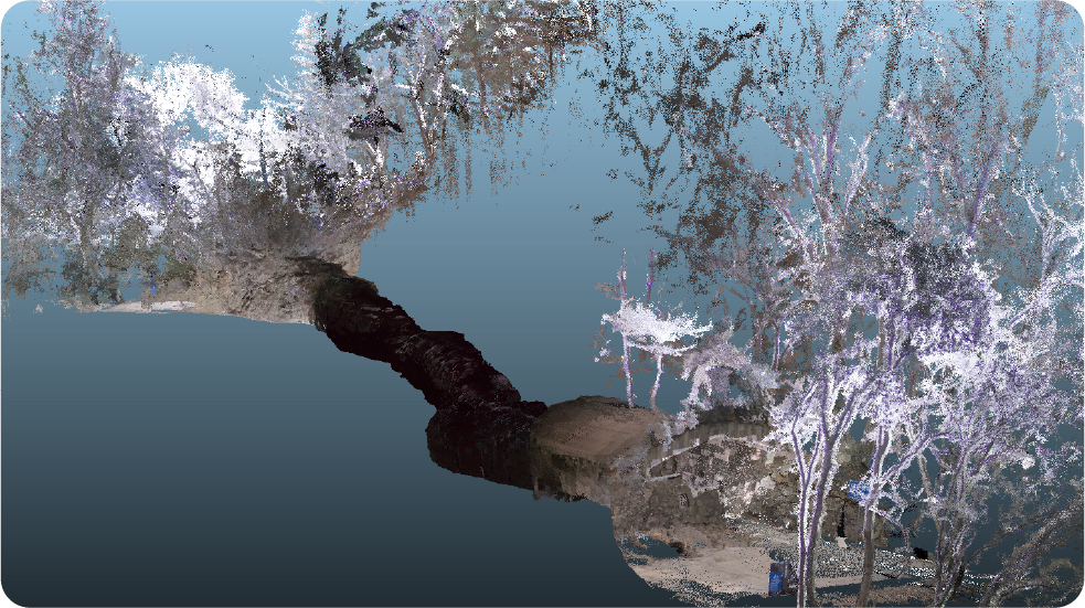
| Color_SLAM | High-precision color 3D point cloud map construction | |||
| Save_Data_Bag | Simultaneous recording of data packets, which can restore the real acquisition process offline | |||
| End_Task | Save the result data to the desktop with one click, convenient and fast | |||
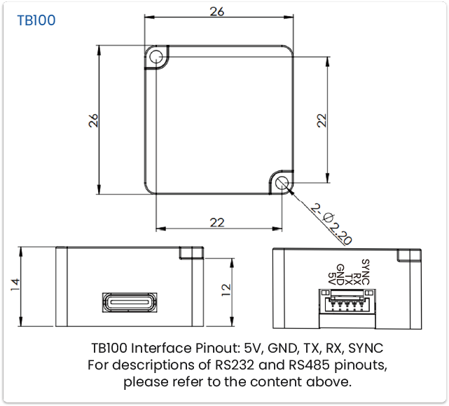
| General parameters | Dimensions (L*W*H) | 98mm*87.2mm*387.8mm | ||
| Power input | 13.8V – 18V | |||
| Power | 36W | |||
| Battery Capacity | 88.8Wh | |||
| Weight | 0.86kg(without battery)、1.43kg(with battery) | 1.2kg (without battery)、1.7kg(with battery) | ||
| Battery life | More Than 150 Min | |||
| Storage Capacity | 128G | 256G | ||
| Product casing | Aircraft aluminum | |||
| Power supply | Magazine battery | |||
| Touch Screen | 3.5 inch@1280×720 | |||
| Computing Unit | Model | Intel N150 | Intel N305 | |
| CPU parameters | 4 core 3.6 GHz、cache 6MB | 8 core 3.8 GHz、 6MB | ||
| Memory/Hard Disk | 16G/128G(Expandable TF card) | 16G/256G(Expandable TF card) | ||
| Wireless Connecting | \ | WIFI /Bluetooth,2.4G/5G | ||
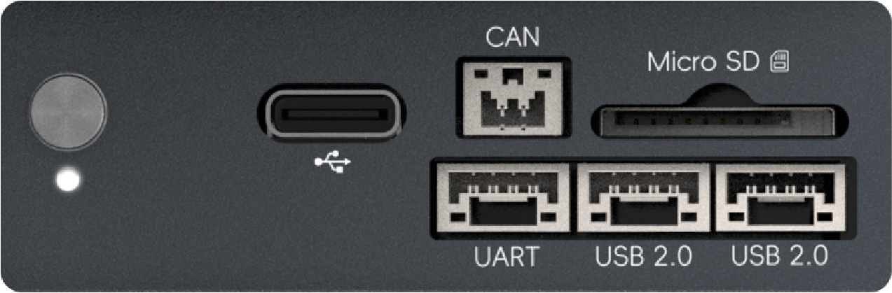
| Secondary development | Micro SD、Type C3.0 | Gigabit Ethernet port,、External Power supply port、Micro SD、Type C3.0 | Gigabit Ethernet port,、External Power supply port、Micro SD、Type C3.0、USB2.0*2、CAN、UART | |
| MicrosecondSynchronization Module | Synchronization Mode | Hardware IO Synchronization Trigger | ||
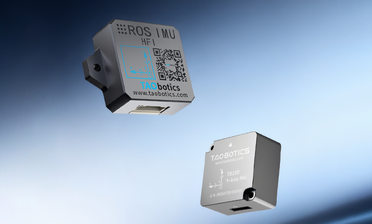
| High-precision IMU | Frequency | \ | UP to 800 HZ | |
| Data package | \ | Acceleration, angular velocity, magnetometer, attitude angle (quaternion) | ||
| Factory calibrated | \ | static, dynamic, NTC, non-linear calibration, axis spacing | ||
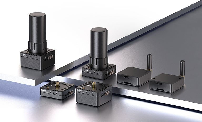
| RTK | Model | \ | T-RTK UM982 Mobile | |
| Antenna | \ | Full-band 4-arm helical stick antenna | ||
| LIDAR | Model | Livox Mid-360 | ||
| Laser Class | Class1/905 nm | |||
| Measuring distance | 0.1m~40m@10% reflectivity , 0.1m~70m@80% reflectivity | |||
| Number and frequency of point cloud | 200,000 points/sec, 10 Hz (typical) | |||
| Field of view | Horizontal 360°, Vertical -7° ~ 52 | |||
| Inertial Measurement Unit | ICM40609,-20℃ to 55℃ | |||
| Industrial Camera | Quantity | 1 | 3 | |
| Exposure method | Global exposure | |||
| Resolution & frame rate | color image, max. 1280×1024@201fps | |||
| Field of view | 180° Fisheye | |||
| Synchronized triggering | Support IO synchronized triggering | |||